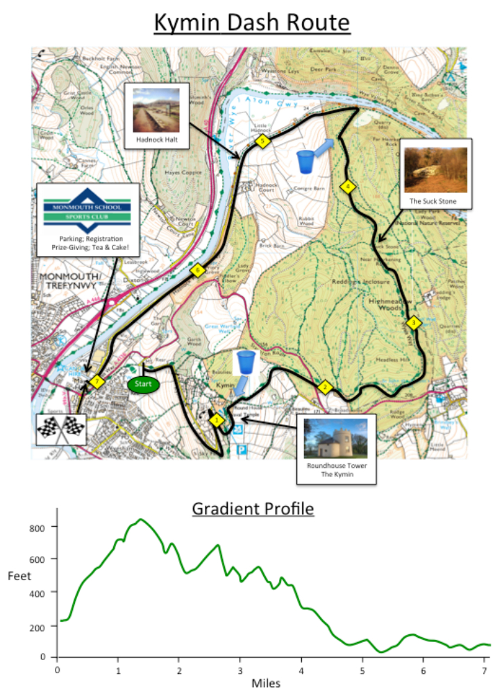
The route will be the same as last year. From the start, at an elevation of about 230 feet, the route climbs the Kymin Road to the Round House at the summit. At the Round House the course levels out briefly – with the first ones there winning the cherished prizes for the ‘King’ and ‘Queen’ of the hill. Passing the Round House, there is a brief chance to enjoy the spectacular views of Monmouth and the Welsh Mountains!
After descending across a field, the route crosses the main road where traffic will be stopped by qualified marshals. [It is possible that the marshals need to hold back some runners for a short time in cases of emergency, or for your safety, or if a build up of traffic becomes a safety hazard for other road users]. The route then follows forest roads for about 3 miles, briefly uphill and then mainly gently downhill through Highmeadow Woods – hopefully carpeted with bluebells by race day. The route passes The Suck Stone (the largest detached boulder in Britain) and below the cliffs of Near Harkening Rock.
After the final descent to the side of the River Wye, the final 2½ miles are relatively flat. It follows the track of the old Monmouth – Ross railway for a mile and then the tarmac Hadnock Road back to the finish at the MSSC. The total distance is 7 miles.